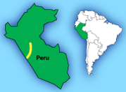
BIRDING ROUTES IN PERU
Central Peru Route
Best April to October; 7 days travel; 250+ species occur, many endemic and threatened
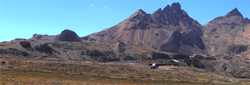
This route covers the entire Andean transect from the Pacific to the Amazonian slope in just a few days. It reaches around 16,000 feet close to Ticlio, so it is a good idea to do this route towards the end of a Peru trip when you have had a chance to acclimatize (e.g. after spending a few days in Cusco). If you intend to do it on its own, you may wish to have oxygen available in the vehicle since the climb to the top is very rapid after leaving Lima. Another option is to fly from Lima to Huanuco and do the route in reverse. Although this does not eliminate the altitude issue, it does allow you to climb slightly more slowly.
The main impression of the route is that the area is heavily mined, and that habitat destruction is rife along the central highway. Despite this, many great birds can still be found relatively easily close to the road. If you hope to see the elusive Junin Rail or grebe it is important to make arrangements in advance. These can be coordinated by ECOAN staff (see contact details on Abra Patricia reserve page). To have a chance to see the grebe with certainty, a boat is important. Otherwise you will likely end up frustrated and uncertain whether you have seen Junin or Silvery Grebe, which from a distance are remarkably similar. The grebes are often far out into the lake so views from the shore are frequently inconclusive.
The route starts along the precipitous Santa Eulalia Road where a number of great endemics can be found along the extremely scenic drive into the highlands. It is worth taking time to make a few stops, but you must start the drive early as it is a slow 100 miles or so on back roads and can take all day. To stand a chance of seeing the White-cheeked Cotinga at Bosque de Zarate you may need to make arrangements to camp nearby so you can search for the cotinga in the early morning. This species is easier to get in Huaraz and you may want to decide if you want to make this side trip or not. It is worth noting that Diademed Sandpiper-Plover is quite a bit more difficult to spot that you would imagine for a distinctively-marked shorebird, and it is worth persisting at both Marcapomacochas and Ticlio in hopes of finding this species. White-bellied Cinclodes is fairly easy close to the road at Ticlio, and look on the lake below for Giant Coot.
Lake Junin is extremely scenic and it is better to access the shore from the rough road that runs along its eastern side. The areas of tussock grass immediately before the lake to the left of the main highway can be good for canasteros and tinamous. As you progress downslope from Junin towards Huanaco there are a few good stops including a small Polylepis forest at La Quina where Giant Conebill can be found. Unchoq is hard to find, and it is important to have a guide or a great map and/or an exact GPS point (ABC is still working on pinpointing the KMZ so don’t use it yet). Golden-backed Mountain-tanager can be found here fairly easily but it is important to walk on the trail (a mile or so) to the best piece of forest. Carpish is relatively easy to bird – the Paty Trail can be found close to a cleared area past what appears to be an abandoned school (perhaps in use again now?). 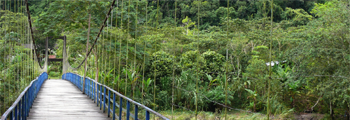
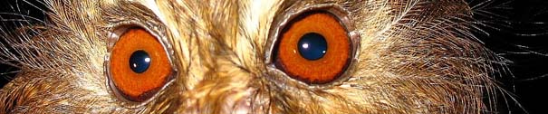
Tingo Maria National Park has visitor facilities and the highlight is the oilbird cave which is easily found. The Tingo Maria area has a reputation for security problems and while it is much safer now than it was in the 1990s, caution is still advised. Asking friendly locals such as hotel staff or park staff what the situation is currently and where to go (and where not to) is a good idea.
You may want to fly back to Lima from Huanuco rather than retracing your steps by road.
Contact us for more info
|